> For the complete documentation index, see [llms.txt](https://docs.onocoy.com/documentation/llms.txt). Markdown versions of documentation pages are available by appending `.md` to page URLs; this page is available as [Markdown](https://docs.onocoy.com/documentation/explorer.md).

# Explorer

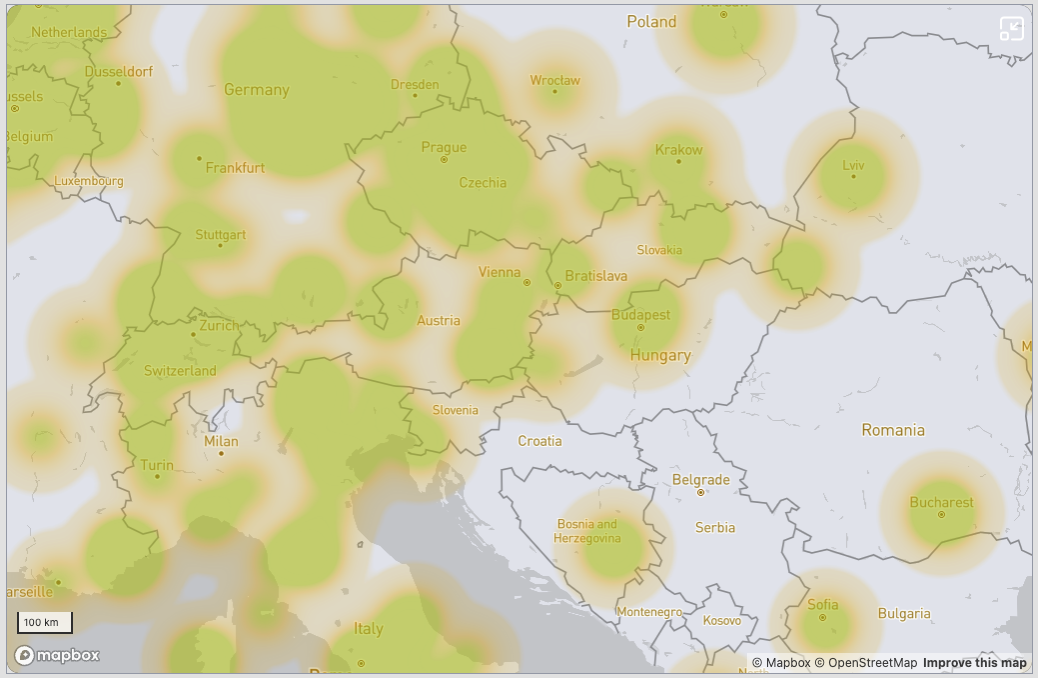
<figure><img src="/files/PeBPYleOBKox1cvFUDcz" alt=""><figcaption><p>The heatmap shows which areas are well covered to receive GNSS correction data.</p></figcaption></figure>

The [explorer](https://console.onocoy.com/explorer) is a tool to discover the coverage of onocoy's GNSS corrections. It is very useful for miners and clients equally.

Open the explorer and you will find a map of the earth with a heatmap on where to find coverage. Zoom in and out to inspect your different areas of interest.

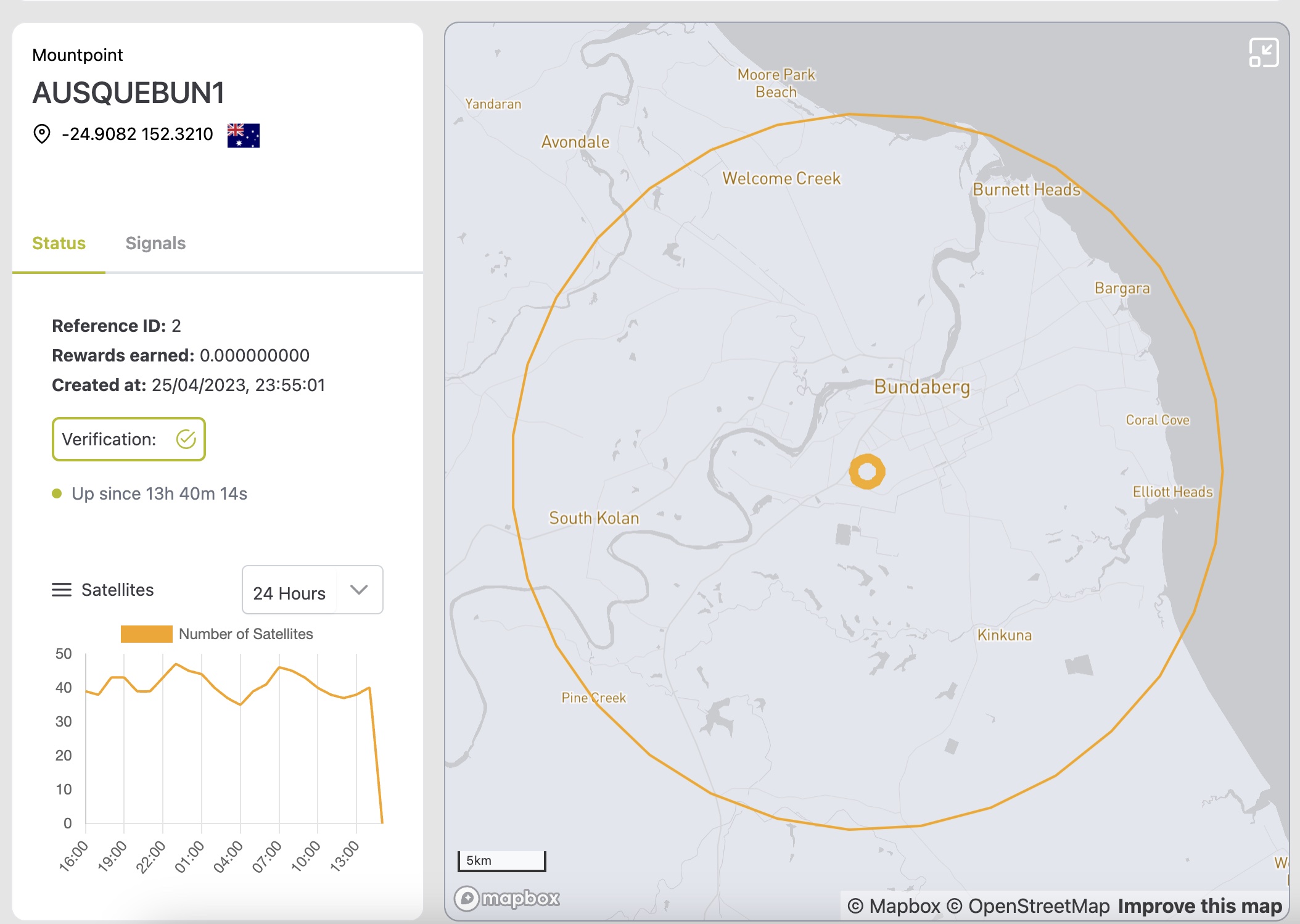
If you zoom in enough, you can click on a specific miner. You will see more detailed information about the station.

<figure><img src="/files/v8SQA1DIRzpfjk96CNmB" alt=""><figcaption></figcaption></figure>

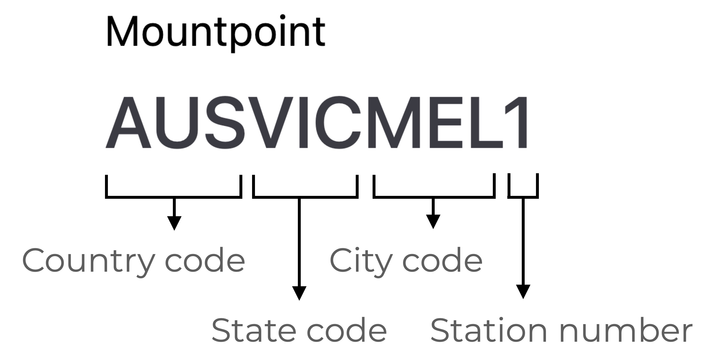
* **Mountpoint:** unique name of the station. It consists of the following name parts:

<figure><img src="/files/QOyg51iG6KWRLeSdpzdj" alt="" width="375"><figcaption><p>Mountpoint name explanation</p></figcaption></figure>

* **Location:** An approximate location of the station that has been validated. The format is in latitude, longitude. A flag indicates the country of the station. Learn about why we don't show the exact location [here](https://docs.onocoy.com/documentation/pages/s10y3x72u38cw8MRRVvq#i-have-privacy-concerns.-is-the-precise-location-of-my-device-antenna-disclosed).
* **Rewards earned:** Total number of rewards for this station since setup. Only applicable if the station owner has registered it on the stream.
* **Created at:** First timestamp of the station being online.
* **Validation:** Status of the validation procedure. If the station has a checkmark, it means it passed the [Data Validation](/documentation/3.-become-a-miner/data-validation.md) process.
* **Up since:** Time the station has continuously been online without interruption.

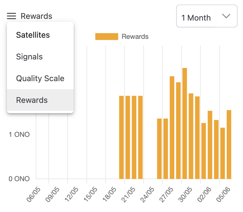
On the bottom of the page, choose a graph from the following:

* **Satellites:** Total number of satellites tracked on average for the given timeframe.
* **Signals:** Total number of signals provided. Find more information about GNSS signals in the [signals section](broken://pages/nQnjcRN2tebiYNff03Gl#what-signals-does-gnss-provide) of [What is GNSS?](broken://pages/nQnjcRN2tebiYNff03Gl).
* **Quality scale:** Percentage of the station's reward based on the signals, their quality and on the location of the station.
* **Rewards:** Estimated rewards earned per day.

<figure><img src="/files/MMrlb8ajg1copk5XWigR" alt="" width="375"><figcaption><p>Click on the 3 bars on the left to choose a chart.</p></figcaption></figure>

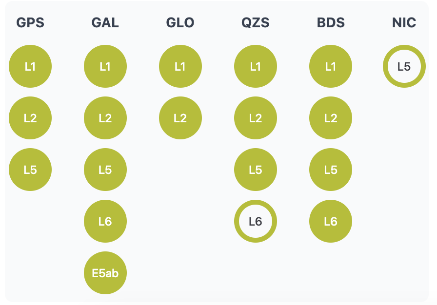
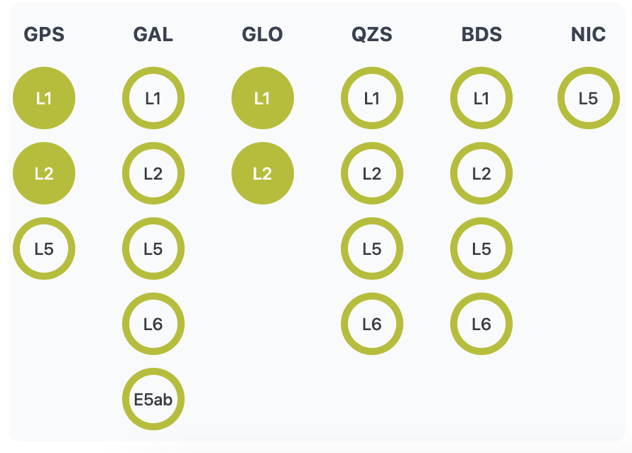
Select the tab *Signals* to see which satellite constellations and frequencies the station is tracking.

<div><figure><img src="/files/57LU2T9ckxl54E7aP2ia" alt=""><figcaption><p>Example for a station with a high number of signals</p></figcaption></figure> <figure><img src="/files/6oqjqWgRGLbSqFuzjg3K" alt=""><figcaption><p>Example for a station with a low number of signals</p></figcaption></figure></div>

* **Constellations:** Provided GNSS constellations. Check out the codes for the different constellations in the panel [What is GNSS?](broken://pages/nQnjcRN2tebiYNff03Gl).
* **Frequencies:** If a frequency is tracked by the receiver, it is marked with a filled circle. For more info on signals, check out the signal section in the panel [What is GNSS?](broken://pages/nQnjcRN2tebiYNff03Gl#why-does-gnss-have-multiple-signals).